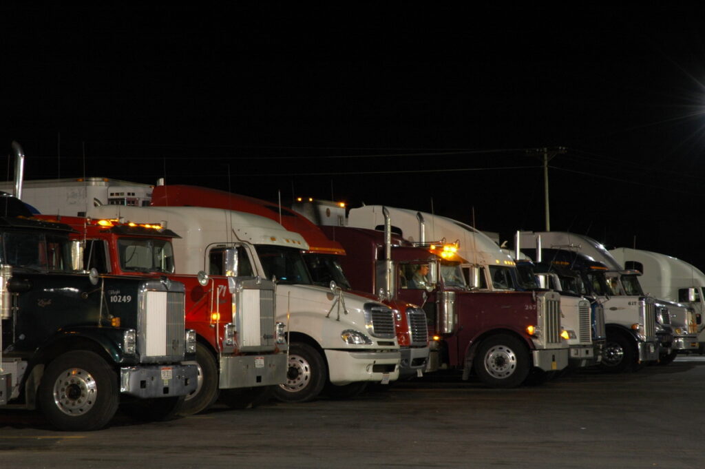
Save the delays with trip planning tips: Driver’s Education
Dale Carnegie famously said, “An hour of planning can save you 10 hours of doing.” In the business of driving a truck, when hours and minutes can really count, careful planning can help prevent unplanned 10-hour layovers.
While Carnegie probably never mapped out a 13-drop trip from Vancouver to Miami, the self-improvement expert was generally a big advocate of planning.
Trip planning provides a big-picture view of a trip – options for the route you will take – as well as granular detail, such as the restaurants and fuel stops available at certain waypoints. A plan will establish milestones along the way to gauge your progress. If you don’t make a mid-point milestone on time, for example, you might have to make alternate arrangements for delivery.
Knowing that ahead of time gives operations and dispatch teams a chance to reschedule if necessary. Shippers are generally more tolerant of delays when they have advance notice. Showing up late and blaming traffic or weather is no longer acceptable.
Where to start
Time and distance are your first concerns. You can calculate roughly how long the trip will take based on the mileage and average speed. Even though most of the trip may be on 65 mph highways, your average speed for the trip will be lower, perhaps 45 or 50 mph depending on how many cities you travel through or around, the density of traffic, and how often you plan to stop. Conservative estimates are better because they naturally build in a little leeway.
You can’t plan for delays, but you can build in contingencies to lessen their impact.
“You should build in a bit of a buffer to account for unavoidable and unpredictable delays,” says Jay Tremblay, a company driver with Morrice Transportation in Windsor, Ont. “With a bit of experience, you get to know how long a given trip will take. But there are always surprises like delays at Customs, accidents, etc. If you don’t leave a little extra time in the plan, you’ll end up scrambling the last 50 or 100 miles. Accidents happen when you’re rushed and frazzled.”
Using a base speed of 50 mph, you can plan on six hours for a 300-mile trip. A thousand-mile trip will require 20 hours of driving. If you plan a 300-mile trip using 60 mph as an average speed, you could theoretically do it five hours, but you’d have no time to stop. Any heavy traffic or construction would ruin your estimate and you’d arrive late.
It’s a good idea to build in extra time if the route takes you through big cities during daylight hours. Accounting for delays in a place like Chicago and the surrounding area could add an extra hour to the trip. Traversing Chicago at night usually won’t slow you down as much.
For example, a trip from Mississauga, Ont. to Minneapolis, Minn. is about 900 miles. If you plan on driving the first leg of the trip during the day, you probably won’t have enough hours to get through Chicago to a truck stop. If you plan the trip to pass through Chicago overnight, you might have enough hours to get safely to Rockford, Ill. before you run out of hours.
Of course, it all depends on the delivery appointment. If they want you in Minneapolis at 8 am, you need to be leaving Rockford at about 2 am. That means you have to arrive in Rockford at 4 pm and take your break. Chances are, you wouldn’t make Rockford from Mississauga in a single driving shift because of predictable delays through the Chicagoland area.
Plan B might see you stopping somewhere east of Chicago, like Gary, Ind. It’s 440 miles from Gary to Minneapolis, or about nine hours. You’d need to leave Gary at 11 pm to make Minneapolis by 8 am. This means you’d need to arrive in Gary at 1 pm, which would require a 5 am departure from Mississauga (factoring in the time zone change).
Or you could plan to arrive in Minneapolis at 10 pm the night before your scheduled delivery. That would demand a whole new set of time and distance calculations to determine a departure time from Mississauga.
Those are the sort of choices drivers need to make, so planning the trip in advance puts some options on the table.
Check the map
Most fleets will have routes to steady customers, which drivers can follow if they are unfamiliar with the operation. Other drivers will often make their own maps, which they might be willing to share. You might also download directions from popular navigation apps. The only caveat here is to ensure the directions were taken from a truck-specific application, such as Rand McNally, ProMiles, PC Miler, Trucker Path, or the like. Google Maps, Apple Maps and Waze are for cars.
Truck-specific navigation systems can be expensive relative to a car GPS. They offer more services, and they include truck size and weight options for choosing routes. The extra cost is always worth it. But to get those extras, you often need to pay for a subscription or an upgrade.
The path to hell can be a short one when one of those mapping apps leads you astray, like off a short pier or down an abandoned railway siding — not to mention the ubiquitous threat from low underpasses. It happens all the time. Just check out the GPS fails on YouTube. Sometimes the root cause of the problem is not with the GPS but simply an incorrectly spelled destination. The other not-immediately obvious problem with GPS is this: if you don’t know where you’re going, you won’t know when you’re lost.
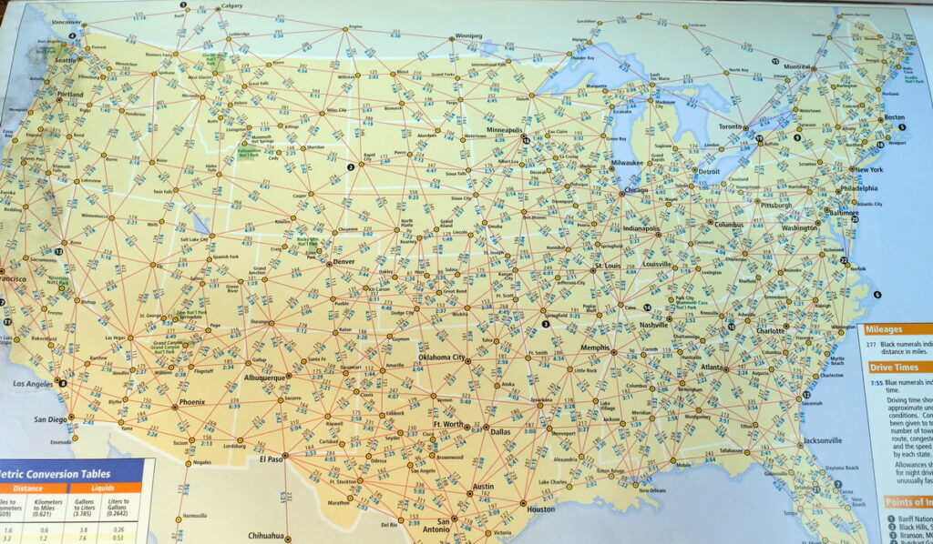
Experienced drivers often cross reference GPS suggestions with an actual road map. The recommended reference is Rand McNally’s Motor Carriers’ Road Atlas. If you’re not familiar with that publication, it has a treasure trove of information highly useful to drivers. It’s not necessarily better or worse than a GPS. It’s just presented differently.
For example, all STAA routes on the maps are highlighted in orange, which are roads approved for all standard truck weights and dimensions. You can also measure distances between exits and various towns by observing the small red or black numbers along the route. You can do that with GPS, too, but you don’t get as a big a picture of an area as you can with a page in the atlas.
“Since GPS navigation became popular, maps went out of vogue,” says Ron Klicka of Tri-County Training Truck Driving School in Ayr, Ont. “Many of our students have never used a map, so we spend a lot of time in class learning how to read the Rand McNally atlas. There’s so much in there drivers can use, but it can be hard to sort out if you aren’t familiar with it.”
His student plot trips as part of a class exercise to get them familiar with trip planning. Klicka says it’s a much-needed skill. “Fleets tell me pre-trip inspections and trip planning are the biggest weaknesses they see in entry-level drivers generally,” he says.
Use the apps
Driver did okay with the tools they had in the days before navigation and trip planning apps came along. The apps just made things easier and more efficient. Exit guides, for example, were once published in a book that sold for $10 or $15, and it was often outdated before it hit the street. There’s an app for that now — and it’s updated more frequently – showing available services at literally every freeway exit in America.
You can find repair services and restaurants, even hair cutting salons, with the push of a button.
Klicka used those apps to drop marker pins anywhere he found a good restaurant or even suitable places to park. “Even as you’re just driving by you can add a pin easily enough and go back and label it later,” he says. “It’s really handy to know where the parking is when you need it.”
Parking capacity and reservation apps are becoming more popular as the risk of not finding parking grows. Tremblay uses them, but sparingly. “If I know I need to be somewhere in the morning and can’t risk not finding a spot, I’ll reserve one,” he says. “This company pays for it, but a lot of companies do not.”
Parking at the customer is an option in some cases, if you have a good relationship with them, Klicka says. “There is nowhere to park on Long Island, but I knew someone with a fondness for Canadian butter tarts,” he says. “So, for the cost of a dozen butter tarts, I have a safe place to park there. It’s all about relationships.”
There’s more to trip planning than just figuring out the shortest distance between Point A and Point B. Shortest isn’t always the best if it’s going to take you into heavy traffic, lots of construction, or bad weather. Many of today’s apps provide live traffic and weather, making it easier to decide whether you want to drive 40 miles out of your way to steer around a traffic jam that’s causing a 15-minute delay.
Tremblay has the benefit now of having run many of the same routes for years. He can estimate with some precision how long a trip will take. New drivers don’t have that advantage, so doing a better job of planning the route, building in contingencies for delays, and looking at alternate routes can help avoid running out of driving time 30 minutes from the customer’s door. That has always happened, but it’s harder to hide those last few miles with an ELD.
Have your say
This is a moderated forum. Comments will no longer be published unless they are accompanied by a first and last name and a verifiable email address. (Today's Trucking will not publish or share the email address.) Profane language and content deemed to be libelous, racist, or threatening in nature will not be published under any circumstances.
I have a very old plasticized map that i bought in 1995it is in excellent shape and shows all you need to now about city highway time to and for the USA Canada and Mexico it is call H,M GOUSHA Mack Millan Publishing USA
this map saved my but many time I also use another old GPS software made for cars bus and other it is call Street and Trips from Microsoft used as reference for calculating time and fuel use it is on my lap top that I carry always with me to use.